Home Blog Page 2209

Camp 18 in northern Oregon includes a logging museum, good eats

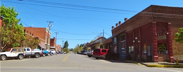
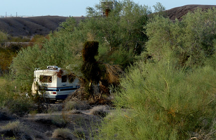
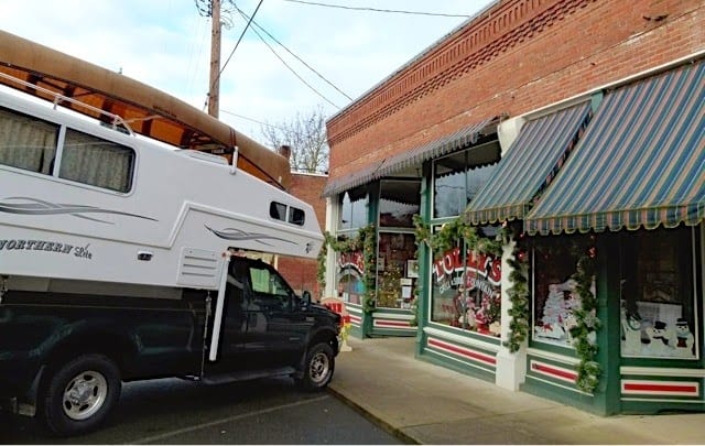
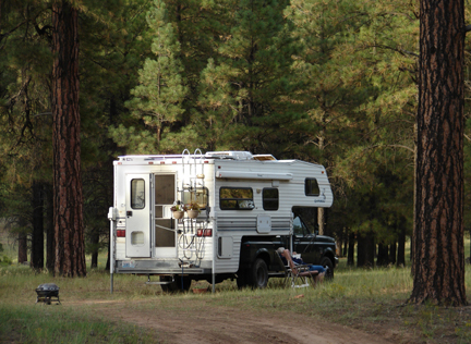
Northern Lite camper at Camp 18 (Julianne G. Crane)

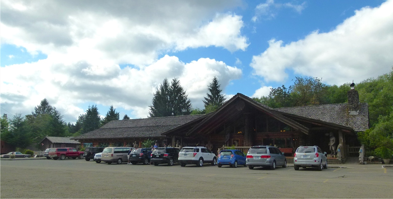
Traveling along Oregon Highway 26, west of Portland, you’ll spot a huge rustic log-cabin restaurant and loggers’ memorial at milepost 18.

There are hundreds of logging-related historic artifacts, tons of antique logging equipment, a logging museum, and generous servings of pretty darn good food–it is called Camp 18.

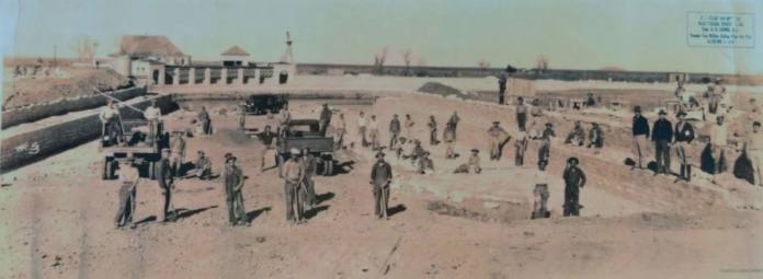
Camp 18 has ample RV parking. (Julianne G. Crane)

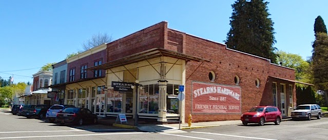
The restaurant-museum complex is near the small rural community of Elsie and was a dream of Gordon and Roberta Smith.

Construction began in the early ’70s with Gordon’s friends joining him in the project.

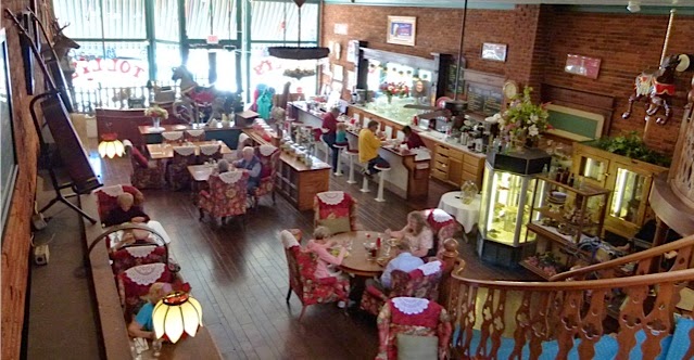
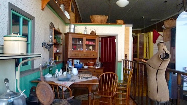
Expansive interior of restaurant. (Julianne G. Crane)

The expansive architecture is authentic in materials and construction techniques.

It features an 85-foot ridgepole (see ceiling) that’s the largest such piece in the United States. It weighs approximately 25 tons and if cut would have 5,600 board feet of lumber in it.

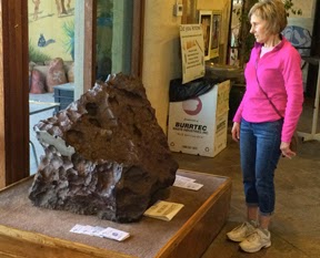
Authentic logging equipment  (Julianne G. Crane)

History buffs interested in the evolution of logging in the northwest will find plenty of outdoor displays including “multiple steam donkeys such as a Dolbeer single spool, a very early first-generation model, to a high-tech late-model Willamette compound geared yarder that was the height of technology for its day.

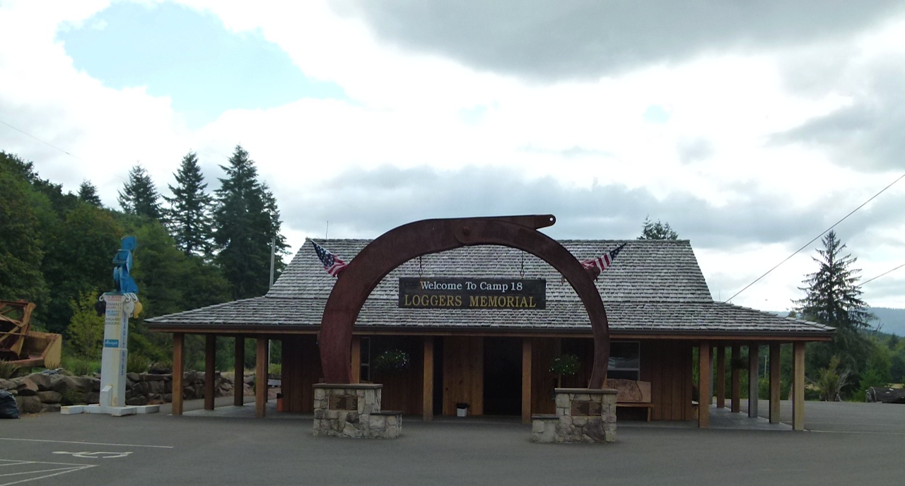
Logging Memorial (Julianne G. Crane)

“Other displays on site include a large bandsaw from a sawmill, a self-propelled Ohio steam crane, Caterpillar-style tracked vehicles that worked in the woods, a railroad skeleton log car and other heavy equipment plus a wide variety of large and small hardware,” according to Camp 18’s webpage.

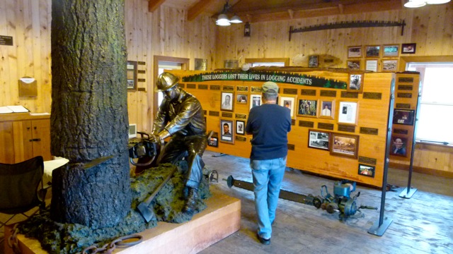
Jimmy Smith in Loggers Memorial. (Julianne G. Crane)

The most recent addition to the complex is the Loggers Memorial located “in a beautiful setting befitting those whose dedication to our forests … will forever be enshrined. This is an opportunity for families and friends to memorialize individuals … who’ve made logging their work, their passion or their life.”

For complete information about the Loggers’ Memorial project, click here.

 If you go:

Camp 18 Restaurant & Loggers Memorial
42362 Highway 26
Elsie, Oregon 97138
Hours of operation are:
Sunday – Thursday 7 a.m. – 9 p.m.
Friday & Saturday 7 a.m. – 9 p.m.

There is plenty of large RV-size parking in the lot.

Julianne G. Crane

To read more articles on RV lifestyle by Julianne G. Crane go to RVWheelLife.com


Photos: (Chick on images to enlarge.) External and interior photos of Camp 18 Restaurant. Some of the authentic logging equipment on display. Jimmy Smith reading through brief bios of dozens of loggers, many of whom died working in the woods. (Julianne G. Crane)

##RVT803

Heceta Head Lighthouse, Oregon Coast

Heceta Head Lighthouse on Oregon Coast (Julianne G. Crane)

The Heceta Head Lighthouse is one of the most, if not the most, photographed lighthouse in the world.

This breathtaking Oregon State Scenic Viewpoint is located on Hwy. 101, halfway between Yachats and Florence along the central Oregon Coast.

A perfect outing for the entire family, the Lighthouse and Light Keeper’s House were built around 1894 and both are listed on the National Register of Historic Places. The working 56-foot lighthouse sits midway up a 205-foot-tall headland.  Its “first order” Fresnel lens casts an automated beam visible for 21 miles out to sea. It is the brightest light on the Oregon coast.

Beach below Heceta Head (Julianne G. Crane)

The Light Keeper’s House is perched further back from the lighthouse on a cliff with a magnificent view of the Cape Cove and the beach below.  The Queen Anne style house features an interpretive center, and bed and breakfast facilities.

A 1/2-mile long walking trail leads from the fee parking lot to the lighthouse while gaining 150 feet in elevation. If you are unable to walk the path, sit at one of the picnic tables or stroll along the beach and take in the magnificent scenery and wildlife.

If you go:
The Heceta Head Lighthouse State Scenic Viewpoint
92072 S. Hwy 101, Florence, OR

Heceta Head (Oregon State Parks)

Lighthouse
– Tours daily, March-Oct., 11 a.m. -5 p.m. (double check on times)
– The lighthouse observation area is open year round during park hours; by appointment throughout year. Call 1-800-551-6949.
– A $5 day-use fee is required. (This pass is good for parking the entire day at any state park. Visitors can leave one day-use fee park and travel to another.)
– For more information: Oregon State Parks.

Light Keeper’s House (OSP)

Interpretive Center
– Located in Keeper’s House.
– Guided tours summer months, Thurs-Mon., 11 a.m.-4 p.m.,  by appointment throughout year. Call: 1-866-547-3696.
– No charge for tours, however donations accepted.

Bed and Breakfast
– 15 guest capacity
– Fully equipped guest kitchen
– Parlors with amazing ocean views.
Operated by a concessionaire of the U.S. Forest Service and can be reached at 1-866-547-3696.  
Best time to call: Monday-Friday, noon-4 p.m. (Pacific Standard Time). On the weekends in and out of the office.
URL:  hecetalighthouse.com/

Source: OSP

Directions
Located on Hwy. 101 on the central Oregon Coast along the Pacific Ocean.
– About 13 miles north of Florence and 13 miles south of Yachats.
– 1/2 mile north of the world famous “Sea Lion Caves” near mile marker #178.

Camping at nearby Carl G. Washburne Memorial State Park.  Click here for more information in an article on RVWheelLife.com.

Julianne G. Crane
Photos:  Chick on images to enlarge.

To read more articles by Julianne G. Crane go to RVWheelLife.com
  

For 66 years the World’s Largest Catsup Bottle has been fun RV Short Stop

A landmark attraction, the World’s Largest Catsup Bottle
proudly stands watch over Collinsville, Illinois.

At 170 feet tall, it includes a 70-foot tall riveted steel bottle sitting atop 100-foot steel legs. The base of the bottle is 25 feet in diameter and the cap is 8 feet across. It has a capacity of 100,000 gallons of catsup … or water.

Originally built as a water tower in 1949 by Caldwell Tanks of Louisville, Ky., it was falling apart by the early ’90s.

In 1993, the Catsup Bottle Preservation Group began fundraising efforts to save the roadside attraction from demolition. Two years of efforts resulted in it being beautifully restored to its original appearance in June of 1995.

An excellent example of 20th century roadside Americana, the Brooks Catsup Bottle Water Tower was named to the National Register of Historic Places in August of 2002.

While the World’s Largest Catsup Bottle attracts numerous tourists every day, the annual birthday bash and car show each summer brings in thousands of visitors.

Mark your calendars for the 17th Annual Brooks® World’s Largest Catsup Bottle Festival Birthday Party and Car (Truck and Bike) Show taking place on Sunday, July 12, 2015, from 10 a.m. to 5 p.m. at Woodland Park in Collinsville, Illinois.

Directions: Collinsville, sits on Interstates 55/70 and 255, in the southwestern region of the Illinois, about 10 miles east of downtown St. Louis, Missouri.

The World’s Largest Catsup Bottle water tower is located at 800 S. Morrison Ave. (IL Route 159) just south of Main Street in downtown Collinsville.

For RV Parks near Collinsville, click here.

Julianne G. Crane

To read more articles by Julianne G. Crane go to RVWheelLife.com

Historic little town of Oakland, Oregon

Historic downtown Oakland, Oregon (Julianne G. Crane)

For RVers who travel through southwest Oregon along I-5, consider taking a couple of hours to explore the small historic town of Oakland and appreciate the architecture of a hundred years ago.

Stearns Hardware 2nd & Locust (Julianne G. Crane)

The town’s two-block business district consists of the original brick buildings built between 1852 and 1890. Stearns Hardware (pictured) has been in operation since 1887.  Oakland was the first Oregon city to be placed on the state’s historic register, in May 1968.

Outside Tolly’s during Christmas Holidays (Julianne G. Crane)

It is said that Oakland has one of the best preserved collections of
classic brick storefronts from the 19th Century. Many of the 80
properties are labeled with their vintage and former use. Today these building are transformed into antique stores, collectible shops, restaurants and taverns.

Inside Tolly’s Grill & Soda Fountain (Julianne G. Crane)

One eatery, Tolly’s Grill & Soda Fountain, is housed in an 1872 building that originally served as the town’s Drug Store and Mercantile.

Opened daily, this cozy restaurant features old fashioned homemade sodas and milkshakes at its restored marble topped fountain.

My personal breakfast favorite is the Tolly’s Pocket Saver: 2 eggs any style with house breakfast potatoes, choice of toast and fresh coffee. All for $5 on Saturday or Sunday.
 

Oakland Museum (Julianne G. Crane)

The Oakland Museum features community’s history from 1851 to the present. Artifacts, photographs and much more are on display.

The museum is open from 12:30 to 3:30 daily and closed holidays, with no admission for entry.

Directions:

Oakland is only a few minutes off I-5, Exit 138 or 140 (North / South) between Roseburg and Eugene. Only 2 miles south of Oakland is Sutherlin where there are three RV parks, read about them by clicking here.

 Click on images to enlarge. (Julianne G. Crane)

Upcoming events

– May 9, 2015 – 12th Annual Classic Car Show and Shine, 10 a.m. – 3 p.m.
Registration of cars begins at 8 a.m., $10 per vehicle. To pre register click here.
Live entertainment by the Oregon Oldtime Fiddlers.
– May 16, 2015 – 23rd Annual City Wide Garage Sale, 9 a.m. until sold out or dusk. Call (541) 459-4531.
June 19-21, 26-28, 2015: Melodrama ‘Rustlers of the Red Rock’ Fri.-Sat. 7 p.m.; Sun. 2 p.m.

To read more articles by Julianne G. Crane go to RVWheelLife.com

Camp next door to the Grand Canyon — escape the crowds and payments

Last year, 4.7 million people visited Grand Canyon National Park.
The huge bulk of these visited the park’s South Rim, easily accessible to the
sweeping hoards coming up from Phoenix
and such points. This travel season it’s likely you won’t get a campsite for your
RV for love or money, at least not without an early reservation. The
campgrounds at the park’s main entrance north of Williams are just too popular.
Here’s a word to the wise. Your intrepid travel writers of
the open boondocks spent several happy days and nights camped out just a
raven’s wing away from the South Rim entrance station. We paid nothing. We
heard almost nothing. We saw very few folks. What’s the secret? Boondock in the
Kaibab National Forest, which girds the
National Park’s loins. There’s lots of good camping not far from the crazy
crowds at the Rim, and Uncle Sam invites you to stay for no fee.
You can ‘spy out the land’ using Google Maps — just put in Tusayan, Arizona,
as your starting point. Zoom in until the town’s details start showing up.
You’ll find the Grand Hotel at the Grand Canyon just east of Highway 180, the
main highway running from Interstate 40 up to the big trench in the earth that
is the truly Grand Canyon. Behind the hotel (to the right or east) is a road
labeled “302.” That’s Forest Service road 302, just one of many roads
snaking through the forest near Tusayan, but this one could be the closest to
the park’s entrance.
If you want “quick access” to the park, just drive
on past the sign that tells you camping is allowed ‘beyond this point.’  You’ll be less than a mile from the highway,
in easy reach of fuel, shopping, and plenty of noise pollution. We made the
mistake of pulling off at the first fire pit rings we spotted coming in the 302
road. We had the folding chairs out, the awning unfurled, and a bit of firewood
gathered in time for the noisy swarms to begin buzzing the camp. We aren’t
talking mosquitoes here, folks. These were big mechanical birds that give
environmentalists fits: scenic helicopter flights. Apparently those first
tempting campsites are right on the main flight line. We managed the noise for
a little over an hour, hoping it might shift. It didn’t, so we did.
Follow that main forest service road north, then follow it
more as it bends east, and keep your eyes peeled. You’ll find a variety of
little pull-out spots heading off into the woods and meadows that make up this
part of the Kaibab
National Forest. We found
ourselves seven miles east of Tusayan, in some of the quietest country we’ve
landed in for a long time. Yes, a few vehicles run up and down the road, but
compared to most places, it’s like paradise restored.
We did find we had to take a little caution with the local
wildlife. Our traveling houseplants were soon off the rig and out in the sun.
Our hanging flower pots were in a famous place — hanging off the roof access
ladder. And my favorite pot of “Hen and Chicks” were soon installed
on the ground under the hanging pots, all the better to catch the excess “runoff”
water. But by Day Two, our little bit of paradise was likewise discovered by a
wayward squirrel — who discovered a whole new world of flavor in those succulent
“Hen and Chicks.” The Wife Unit thought the little marauding rodent
was a gas as he selectively picked his way through my baby greens, but Mr.
Squirrel was soon thwarted when the Hen and Chick family was relocated to the
hood of the truck.

There are months of wonderful camping weather just ahead of
us. Just be sure you keep your potted peonies secured from rodent rage!

Norcold RV refrigerator recall information

RV fire safety expert Mac McCoy discusses an important recall of some popular models of Norcold RV refrigerators. The refrigerators

Oasis Date Gardens in Cochella Valley = cool, tasty desert short stop

Oasis Date Gardens in Thermal, Calif.  (Julianne G. Crane)

If you are a Snowbird migrating through the arid regions of the Coachella Valley in southern California, you can’t help but be lured by the “Ice Cold Date Shakes Just Ahead” signs that dot the highways around Palm Springs, Indio and Desert Hot Springs.

Shady picnic area (Julianne G. Crane

On one hot day, as we were traveling along CA. 111 in Thermal, we pulled into the Oasis Date Gardens parking lot.

In addition to an inviting shady picnic area outside, the cool inside offers a Ranch Store, Sampling area, Cafe and a small theater that shows a video on how dates are grown. There is an antique farm implement display where visitors can guess their use from days gone past.

If you are there at 10:30 a.m. and 2:30 p.m. stay for the educational talk. 

We discovered that California dates have grown in the desert oasis of the Coachella Valley for more than a century. “A place where date palms flourish in high summer temperatures and low humidity with minimal rainfall during the summer and fall.”

We were also happy to learn that Oasis Date Gardens has been certified organic since 2000. The owners “not only believe that it is important to grow a beautiful varietal date, but also one that is rich in flavor. We believe the best way to ensure that our dates reach their full sweetness and flavor is to use natural fertilizers and let the tree ripen the date to the fullest extent possible,” according to the company’s literature.

Jimmy Smith sampling dates. (Julianne G. Crane)

“Consequently, Oasis Date Gardens has adopted an organic farming approach to growing and processing their dates. In plain simple terms this means that all fertilizers are natural, such as using composted chicken litter or cover crops to enhance the nutrients of the soil rather than chemical fertilizers. Also no chemicals or pesticides are used in the gardens. Only natural elements approved under the guidelines established by the National Organic Standard.”

During our visit to the store we sampled many tasty organic varieties of locally-grown dates.

We next stepped over to the cafe (between 9 a.m. and 3 p.m.) to check out the date cakes, cookies, bread and pies baked fresh daily. The menu includes salads and deli sandwiches (between $7 and $8). Above all, you must try their famous date shake for $4.

(Julianne G. Crane)

If you go:

Oasis Date Gardens
59-111 Grapefruit Blvd.
Thermal, CA 92274
URL: oasisdate.com
(800) 827-8017
Store Hours: Daily, 9 a.m. to 4 p.m.

Julianne G. Crane

To read more RV Lifestyle articles by Julianne G. Crane go to RVWheelLife.com

Belt sander races dust up Fulton, Texas

Inspecting belt sanders before race. (Julianne G. Crane)

Prior to the beginning of the recent South Texas Belt Sander Race Association sanctioned Saturday afternoon races, hundreds of spectators milled around the 75-foot track behind the Legends Saloon in Fulton, Texas.

Cars, RVs, motorcycles and bicycles started packing the parking lot and
side streets shortly after noon. Mostly Winter Texans
filled the colorful bleachers, drank beer and rooted for every sander
that managed to kick up a cloud of sawdust in the double-elimination
races. The sun was out, a festive feel was in the air and everyone was there to have fun watching belt sanders drag races.

For the uninitiated, there are two classes of belt sanders: Stock and Modified.

First of all, however, all sanders must run on 120v power, use an unmodified factory-manufactured sanding belt (grit is driver’s choice), be equipped with track guides and wheelie bars or ‘outrigging’ (to keep sanders centered in the 12-inch wide track), and be no more than 24 inches in length.

The “stock” class sander, says Tommie Giambernard of the South Texas BSRA, “is essentially fresh out of the box. You can make them pretty with a good paint job, but that’s all.”

‘The belt sanders are off and racing.’ (Julianne G. Crane)

The “modified” class, on the other hand, has no limits. Racers can do
anything to them, as long as they stay within the general requirements
(see above). Some racers have been known to spend several thousand
dollars modifying the engines to go as fast as 20,000 RPMs. (The average
off-the-shelf belt sander runs 1725-3450 RPMs.)

John Hillstrom, an RVer from Puyallup, Wash., wasn’t doing anything fancy. “I’m just here to enjoy myself.” This is his first season and he is running in the stock category. “I spent a total of $160,” he said, “$80 for the sander, $20 for an extended warranty, $20 for sandpaper, $20 for outriggers and $20 for paint.”

Legends Saloon (Julianne G. Crane)

If you go:
Legends Saloon
3720 N. Hwy. 35
Fulton, Texas
When: 1st and 3rd Saturday at 2 p.m., Oct.-March

Cost: Free

For more information:
South Texas Belt Sander Race Association
URL:

Orginally posted in February 2011, this article was updated with current information on Feb. 21, 2015. To read more about the RV Lifestyle click on RVWheelLife.com

Julianne G. Crane

Photo: Top: Spectators inspecting the couple dozen belt sanders lined up near the raceway’s starting point. Middle: (l) Tommie Giambernard’s stock belt sander noses out John Hillstrom’s entry at a Saturday afternoon race.  Bottom: Sign outside Legends Saloon in Fulton, Texas. (Julianne G. Crane)

Cheated out of raisins


After a trip to the grocery store in Elkhart, Indiana, I was reminded of how food companies play tricks on us with their packaging. Heck, not just tricks, they cheat us and force us to pay for extra packaging that isn’t even necessary.

Quechan Tribal lands: Great boondocking close to Old Mex

Need your teeth worked on? How about a pair of glasses? Some inexpensive liquor? If you’re an Arizona snowbird, one of the most popular border crossing spots into Mexico for prescription drugs, liquor, and shrimp tacos is at Los Algodones, just west of Yuma. The little town has more dentists per capita than there are lobbyists in D.C. But the hang up is, where do you stay with your RV? Yuma’s tight-fisted city ordinances prohibit “blacktop boondocking.” Yes, you can stay in one of the myriad of RV parks, but if you’re a nature lover, or just want to camp for a little less, stick around.

Just north of the border crossing into Mexico the lands are under the control of the Quechan tribe, and those sandy dunes with their mesquite dotted shady spots are available for boondocking–although in some cases, for a price. If you’ve crossed the All American Canal, you’ve no doubt seen plenty of rigs up on the bluff overlooking that short stretch of highway that leads to Old Mex. Yep, that’s Quechan land, and so is the road running along the south side of the All American Canal. On the canal side of the road, “No Parking” signs are there for a purpose–the American government who controls that side of the road doesn’t want you there. Period.

On the south side of that road, particularly farther back on the west end, you’ll find folks boondocking alongside the road, and down in the lowlands. Years back, if you decided to “put in,” you could be sure to meet up with Rick, the Mayor of the All American Canal. His honor came by the title by right of longevity. Rick had been seasonally staying on here for seeming ages, hunkered down in a older, modest RV. On one visit, he stopped by our rig, ostensibly on his way to a meal-time gathering of other RVers, but in reality, to make sure we weren’t–as he describes them–“riff-raff and drug users.”

A tall, slender man, who traveled alone and espoused healthy diets and right living, Mayor Rick could easily talk your leg off. At a couple of points other “locals” stopped by to see if we needed rescuing. “Don’t believe a word he says!” warned one man. Our “savior” and the mayor exchanged friendly barbs. The Mayor summered in the cooler climate afforded by New Mexico, but spent months down by the canal, in “walking distance” to Los Algodones. Walking distance? Perhaps this said something about Mayor Rick’s health–it’s a pretty long stroll to Old Mexico, even from here.

It’s been a long spell since we’ve seen the Mayor – it may well be that he’s off the scene. But you can still camp on the lands that the Mayor called his own. Here’s a couple of notes though: The Quechan Tribe oversees their lands diligently and ask you pay for a permit to stay there. Short-timers, you’ll pay $10 a day, per person. If you’d rather stay long-term, you can obtain a permit good for a fiscal year (which starts July 1) for $80, and not only allows camping, but also provides fishing rights. You can get a permit in nearby Winterhaven at the Hub Liquor store, or close to the Old Mex border at the Sleepy Hollow Campground.

Since a dump station and fresh water aren’t available here, it may seem a bit steep a price, but as is said, it’s one of the few boondocking places within striking distance of Yuma, and certainly handy to the less expensive medicine and dental services of Old Mexico. But if you’re riff-raff or a into drugs, be aware: The Mayor doesn’t want you here.

Catch Russ and Tiña’s new audio podcast, Your RV Podcast, a weekly feature. Visit www.YourRVPodcast.com to see program notes and a link to the audio feed. 

San Solomon Springs “A Desert Oasis” at Balmorhea State Park in west Texas

San Solomon Springs pool from diving board.Julianne G. Crane)

Situated about about seven miles south of I-10 on Hwy. 17 in west Texas, Balmorhea State Park is known as “A Desert Oasis” for its 77,053 square-foot San Solomon Springs pool. It is reported that 22 – 28 million gallons of water flow through the spring-fed swimming pool each day.

CCC digging the San Solomon Spring Pool (circle 1936)

The 45.9-acre Balmorhea State Park was constructed by Company 1856 of the Civilian Conservation Corps (CCC) between 1936 and 1941, according to the Texas State Parks web site. The CCC was established as a New Deal program by President Franklin D. Roosevelt during the Great Depression as a way to employ people who would have otherwise been out of work. (Click on images to enlarge.)

San Solomon Spring Pool 2014. (Julianne G. Crane)

Said to be the world’s largest spring-fed swimming pool, covering 1.75 acres, its water stays at 72–76 degrees year round. The pool ranges from 3.5-feet to 25-feet at the deepest point. Scuba divers love the clarity, even at a 25-foot depth.

Scuba divers test the waters. Julianne G. Crane)

“With a capacity of more than 3.5 million gallons, the pool has plenty of room for swimmers, offering a unique setting for both scuba and skin diving.”

“Other CCC structures in the park include a limestone concession building, two wooden bathhouses, an adobe superintendent residence and the San Solomon Springs Courts offer motel-style retro lodging. All of the CCC buildings are constructed in a Spanish Colonial style of adobe bricks with stucco exteriors and tile roofs.”

Viewing platform along the canal. (Julianne G. Crane)

“In addition to swimming and camping, canals from the springs pool lead to a restored ciénega (wetland). San Solomon Springs is home to assorted invertebrates, turtles and endangered fish, including the “rare and declining” Headwater Catfish.

Young headwater catfish. (Julianne G. Crane)

“Found exclusively in spring-fed streams of the Pecos and Rio Grande basins, the headwater catfish prefers shallow runs like this canal where it finds shelter and food among rocks and aquatic vegetation. There are fewer headwater catfish today than in decades past due to habitat loss and hybridization with channel catfish. Balmorhea State Park remains one of the last strongholds of survival for this species,” states a park information board.

Other animals seen in the park include resident and migrant birds, deer, javelina, hawks, barn swallows, waterfowl, ground squirrels and roadrunners.

For information on the Balmorhea State Park campground that features 34 campsites, click here for a post I wrote for RVWheelLife.com.

Balmorhea State Park
P.O. Box 15
Toyahvale, TX 79786

URL:
Latitude: 30.944829
Longitude: -103.785147
URL: www.tpwd.state.tx.us/state-parks/balmorhea
Fee: Swimmers pay only the $7 day use fee.

BTY: From Mon., May 4–Sun., May 10, 2015, San Solomon Springs pool will be closed for annual cleaning.


For more articles by Julianne G. Crane about RV lifestyle go to RVWheelLife.com.
Photos by Julianne G. Crane.

See a giant-sized meteorite in Barstow, California

0

Trip Update: Thursday, Jan. 16, 2015

If you happen to be in Barstow, Calif., which is in the desert northeast of Los Angeles, you should stop by the California Desert Information Center to see the Old Woman Meteorite. It’s the second largest meteorite ever found in the USA, weighing about three tons. It’s mostly iron, which accounts for much of its weight. It came from the Asteroid Belt, which is located in an orbit around the sun between Mars and Jupiter.

There is no need for a burglar alarm on the rock because nobody could ever pick it up without going to lot of trouble. It look a huge effort by the U.S. Marines and a helicopter to lift it onto a truck to bring it to the museum, where it is a big attraction. Three prospector’s found it in 1975 in the Old Woman Mountains in San Bernardino County. So that’s how it got its name.

PART OF THE METEORITE was sawed off and taken away to be studied. But most of it is still here.

Chances are, this is the oldest thing you will ever see or touch in your life. It’s not pretty. It’s just a big rock. Still, it’s impressive.

Now, your science lesson: All meteorites were once a meteor. They became a meteorite if they made it to the ground without vaporizing, as most do. Most meteorites are dust particles and weigh about .0005 ounces. So the Old Woman Meteorite is a biggie!

The largest meteorite ever found was in Africa and weighs 60 tons. The largest one in the United States, at 15 1/2 tons, landed in Oregon.

Admission to the see the Old Woman Meteorite is free. There are other things to see, too, plus a gift shop where you can buy some cool rocks, but no meteorites.