Home Blog Page 2210

Wickenburg’s Gold Rush history, Western Sculpture Walk = fun Snowbird RV Short Stop

“Jail Tree Felon” by J Seward Johnson.  (Julianne G. Crane)

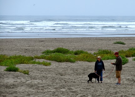
RVing Snowbirds who are roaming the southwest Arizona byways will soon discover Wickenburg, once voted the “Most Western” town in the west. About 60 miles northwest of Phoenix, True West magazine put Wickenburg in the “Top 10 List of True Western Towns of 2008.

It seems in the mid-1800s Henry Wickenburg came to the area in search of gold and discovered the Vulture Mine, where over $30 million in gold was found. There are still relics around the area that stand as a tribute to these early adventurers as well as a walking tour around Vulture Mine, according to the Wickenburg Chamber of Commerce.

Each year the town celebrates “Gold Rush Days” (Feb. 12-15, 2015). “The heritage event was founded 67 years ago, and today Gold Rush Days draws tens of thousands of visitors, during the 3 ½ days of activities. Gold Rush Days most significant recognition is from the Library of Congress, whereas Gold Rush Days is one of America’s Living Legacies,” says the Chamber.

“Vaquero with Guitar” (Julianne G. Crane)

To add a contemporary touch to Wickenburg’s western attractions, with an affectionate nod to its history, the town commissioned realistic life-size bronze sculptures that are threaded through the old section of town.

The sculptures are a series of six old western characters and 16 linking animal pieces by renowned artist J. Seward Johnson. The artist’s work is in private and public collections around the world.

An added feature is that each large sculpture includes a button with a narrative on the history of the area.

The public art includes “Jail Tree Felon” (top) that depicts “the use of the large mesquite tree as a place to chain prisoners in early Wickenburg days until they could be transported to the nearest jail in Prescott. It is located at the Jail Tree Park on Tegner Street (Hwy-93) by Chaparral Ice Cream Parlor and Circle K.”

Vaquero with Guitar” (above right) provided “an evening serenade to downtown visitors in the late 1800’s and early 1900’s. He strums on Wickenburg Way (Hwy-60) in front of the Gold Nugget Lounge.”

Gila Monster (Julianne G. Crane)

The 16 smaller bronzes “depict local desert creatures including gila monsters (left), roadrunners, tarantulas and rattlesnakes. They provide linkage between the six major pieces.”

If you go:
Sculpture Walk
Cost: Free
Hours: 24/7
URL: WickenburgChamber.com
Phone: (800) 942-5242

For more articles by Julianne G. Crane about RV lifestyle go to RVWheelLife.com.

Click on photos to enlarge: From top: ‘Jail Tree Felon,’ ‘Vaquero with Guitar,’and ‘Gila Monster.’ (Julianne G. Crane)

Borrego Springs is backdrop to 140 free-standing amazing metal sculptures

Scattered across the southern California desert near Borrego Springs are more than 140 amazing life-size depictions of animals that are said to have roamed this same landscape from prehistoric to present times.

Jane Justis admiring Dragon’s head (Kevin Justis)

Known as the Galleta Meadows Sculptures, the menagerie includes a 350-feet serpent (right), mastodons, dinosaurs, wild pigs, sabertooth tigers, ancient camels, wild horses and longhorn sheep.

Dennis Avery, who passed away in 2012, an heir to the founder of one of the world’s biggest label-making companies, was the master mind behind this massive installation of free standing art.

According to an article in the San Diego Reader, Avery “learned from open-space advocates that land in Borrego Springs was selling for rock-bottom prices. He wound up buying a number of noncontiguous parcels that added up to about three square miles of the town.”

Back in 2006, Avery underwrote the publication of Fossil Treasures of the Anza-Borrego Desert, (Sunbelt Publications). The book about the unusual paleontology of Borrego Springs included “detailed illustrations of the region’s landscapes over the past five million years and the creatures that once lived there,” according to the San Diego Reader.

Avery envisioned taking the illustrations in the book into three-dimensions and commissioned artist/welder Ricardo Breceda to create life-scale original steel sculptures to be placed on his property. The first sculptures–three giant tusked gomphotheres, ancient members of the
elephant family (pictured here)–were erected in the spring of 2008.

Breceda’s creates his works in his welding studio in Temecula, Calif.  “I just look at a drawing,” said the self-taught artist, in a video posted on ‘Road Trip’ on KPBS San Diego. “All I need to know is the size and we go from there.”

Using recycled metal for the frame, Breceda welds rolled steel “together bit by bit” for the exterior.

For a map of the sculptures click on here. Sculputres are accessible via an easy driving tour. Free admission, 786 Palm Canyon Drive, Borrego Springs, Calif., (760) 767-5555.

There is RV camping available at nearby Anza-Borrego Desert State Park where there are developed campgrounds. Many visitors approach the park from the east or west via Highways S22 and 78.  Highway S2 enters the park from the south off of Interstate 8.

—  Julianne G. Crane  First published on 11/30/2011, updated 12/30/14.

.
To read more by about the RV lifestyle by Julianne G. Crane click on RVWheelLife.com

Photo: RVer Jane Justis of Susanville, CA., stands under part of artist Ricardo Breceda’s 350-foot serpent near Borrego Springs. (Photo by Kevin Justis) Bottom: The first sculptures were “Gomphotheres,” ancient members of the elephant family (Courtesy: Galleta Meadows).

RV slide leak costs $13,000 to fix. What happened?

In this video, Valley RV Supercenter’s Chris Nelson shows the horrible damage that resulted from a leak in a Class

Kentucky Bourbon Trail … Maker’s Mark Tour

When you find yourself in Kentucky, especially anywhere between Lexington and Louisville, you can’t help but be taken over by the “Bourbon Spirit.”

Kentucky has a “rich history and proud tradition” of crafting the state’s signature spirit. “It began in the 1700s with the first settlers of Kentucky. Like most farmers and frontiersmen, they found that getting crops to market over narrow trails and steep mountains was a daunting task,” according to Kentucky Distillers’ Association’s website.

“They soon learned that converting corn and other grains to whiskey made them easily transportable, prevented the excess grain from simply rotting, and gave them some welcome diversion from the rough life of the frontier.

“Since then, generations of Kentuckians have continued the heritage and time-honored tradition of making fine Bourbon, unchanged from the process used by their ancestors centuries before.”

Monster warehouses dominate the landscape in ‘Bourbon Country’ (Julianne G. Crane)

The importance of the Bourbon industry is clearly obvious when driving through this part of Kentucky. Ominous monolithic warehouses dominate much of the landscape.

RVer Jimmy Smith walking among the “spirits.” (Julianne G. Crane)

These huge warehouses store the aging ‘spirits’ that have helped create “9,000 jobs, generate more than $125 million in tax revenue each year, and is a growing international symbol of Kentucky craftsmanship and tradition.” Learn more by clicking
on: Kentucky Distillers’ Association’s web site.

 The process begins. (Julianne G. Crane)

In 1999, the Kentucky Bourbon Trail® tour was formed to give visitors a firsthand look at “the art and science of crafting Bourbon.” Nine distilleries, seven of which are within 35 miles of Lexington, dot the Bourbon Tour.

Bourbon tourism has skyrocketed since then, with nearly 2.5 million visitors to the Bourbon tour in the last five years alone, according to industry folks. We were two of those millions when we drove the windy back-country roads to the Maker’s Mark Distillery, a National Historic Landmark that is nestled in Loretto, Kentucky, in the rolling hills of Marion County.

Maker’s Mark Visitors Center (Julianne G. Crane)

Maker’s Mark Distillery
3350 Burkes Spring Road
Loretto, Kentucky 40037
270-865-2099

Tour: $9 for adults (helps defray the cost of the tasting samples for those of legal drinking age)
Hours: Monday – Saturday, 9:30 a.m. – 3:30 p.m.
Sunday (March through December) — 11:30 a.m. – 3:30 p.m.
Grab a bite to eat at the Tollhouse Cafe.
www.makersmark.com

During the winter months, it is highly recommended that visitors call the distilleries you plan on visiting before heading out to double check that they are open.

For camping, click here to read about the nearby My Old Kentucky Home State Park in Bardstown, open from April 1-Nov. 1.

To read more RV lifestyle articles by Julianne G. Crane, go to RVWheelLife.com.

(Photos: by Julianne G. Crane)

Will ice cubes in an RV sewer tank dislodge waste buildup?

0

A buildup of solids in an RV sewer tank is a bad thing. So getting rid of the yucky mess

Nez Perce Bear Paw Battlefield … “I will fight no more forever” — Chief Joseph

It was 137 years ago on Oct. 5, that Chief Joseph of the Nez Perce surrendered following the final battle of the four-month Nez Perce War of 1877 at the Bear Paw Battlefield.

Jimmy Smith reads about the Nez Perce War. (Julianne G. Crane)

“The 1877 flight of the Nez Perce from their homelands while pursued by U.S. Army Generals Howard, Sturgis, and Miles, is one of the most fascinating and sorrowful events in Western U.S. history,” according to the U.S. Forest Service’s Nez Perce National Historic Trail Webpage.

“Following the breakout of war in Idaho, nearly 800 Nez Perce (including elders, women and children) spent a long and arduous summer fleeing U.S. Army troops, first toward Crow allies and then toward refuge in Canada,” states the National Park Service’s Webpage. Nearly 100 died on the journey.

On Sept. 30, 1877, after traveling 1,170 miles through the mountains and only 40 miles short of the Canadian border, “400 troops and 50 scouts” surprised the Nez Perce encampment and attacked at dawn.

Battlefield marker (Julianne G. Crane)

Chiefs Looking Glass, Ollokot, and Too-hul-hul-sote along with many other warriors and Native people were killed during the five-day battle and siege in snow and freezing conditions.

The Nez Perce surrendered their weapons on Oct. 5.

“Some of the soldiers wrote in their journals that it was the coldest weather they had ever experienced,” said Bear Paw Battlefield park ranger Stephanie Martin.

It is recorded that Chief Joseph spoke the following words on abdicating:

Chief Joseph’s words. Click on image to enlarge. (Julianne G. Crane)

The battlefield is part of Nez Perce National Historical Park and Nez Perce National Historic Trail.

Battlefield sign. (Julianne G. Crane)

If you go:
– Bear Paw Battlefield from Chinook, Mont., (on Hwy. 2) travel 16 miles south on Route 240.

– Once there, walk the 1-1/2 mile self-guided trail to get a greater feel of this sacred site.

– There are picnic tables and vault toilets available.

– No charge.

To read more RV lifestyle articles by (Julianne G. Crane), go to RVWheelLife.com.


Photos from the top: Jimmy Smith reads about the Bear Paw siege. There are numerous plaques along the trail that mark significant points of the battlefield. Chief Joseph’s words on surrendering at Bear Paw Battlefield on Oct. 5, 1877. Photos by Julianne G. Crane.

Help diagnose RV’s A/C health with infrared thermometer

RVtravel.com’s technical editor Chris Dougherty shows you an infrared thermometer and demonstrates how it can be used to help determine

Park your RV on a Washington beach: Pacific Beach (video)

Finding a special place along the ocean beach is sure a rarity. Up in the Pacific Northwest, there aren’t too many places where you can take your RV right out to the beach and stay for a day or two. But north of the mouth of Grays Harbor, about center point along the north-south Washington state line, lies the little burg of Pacific Beach.

The state maintains a park in Pacific Beach by the same name. Perched on the beach, in some sites you can sit in your rig and watch the tide roll in and out. Kite fliers and beach combers spend plenty of time decorating the seascape, and overall, its a quiet, relaxing park.

Some summer visit, you may catch those occasional brilliant days of blue sky and sunshine. But Washington’s weather is notably fickle, and a two-hour stretch of sunlight can suddenly change into wind-driven rain that may hang around for weeks. Come winter, park in some of the “ocean front” sites and you can watch winter storms toss the waves around, helter-skelter.

Years back, you could come nearly anytime you liked and find a place to park your rig. But like a lot of those things we “love too much,” nowadays you’d best have a reservation year-around.

Top picks for ocean views? Sites 1 through 6 are great, non-hookup areas. Several of these back up to a bluff, and you can drag your chair up on the bluff and have almost a private outlook over the beach. Sites 7 and 8, and 17 through 30 too, have super ocean views, and offer partial utilities. The park has other non-ocean view spots, too, that cost a few dollars less than view sites.

Welcome your guests with style!
The coolest RV doormat!
You
will be the talk of the RV park with this incredibly cool doormat. This
vibrant 18″ X 30″ Rubber-Master non-slip door mat is made of 95 percent
recycled rubber bonded to a non-woven polyester surface. Unlike a
traditional doormat, this one is durable and easily cleaned with soap
and water. Ya gotta love this! Order for less than $20.

Otter Crest Viewpoint on Oregon Coast

Otter Crest Viewpoint looking south on Oregon Coast. (Julianne G. Crane)

The Oregon Coast Highway has long been a favorite scenic byway for RVers who want to travel at a leisurely pace and soak in some of the most beautiful vistas in America. And, the Oregon State Parks has provided numerous pullouts for the millions of annual sightseers and photographers.

For RVers, a great time to travel this popular route is in the autumn and winter when there are fewer families on the road and camping sites at state parks are easier to come by.

On one recent trip along the northern Oregon Coast we pulled out at the Otter Crest State Scenic Viewpoint. It thrusts out into the Pacific Ocean between Newport to the south and Depoe Bay to the north. It is a beautiful place to take a few snapshots, stretch your legs or fix a bite to eat.

Looking north from Otter Crest(Julianne G. Crane).

However, there are a couple of possible downsides for folks traveling in an RV:

– Traveling north, entry to the viewpoint is on the outside curve and signage was a little confusing. We missed the first entry and turning into the second access road was challenging because of the awkward approach and heavy oncoming traffic. However, there is a protected turn lane.
– Parking is extremely tight for larger rigs and any outfit towing a trailer or boat/car. 

– Only toilet facility available the day we were there was one porta-potty that had not been service in a long, long time. (Thank goodness for self-contained RVs.)

That said, upwards of half-a-million travelers pull off the coast highway each year for the spectacular view from 500-feet “above the ocean on the breathtaking crescent sweep of white sandy beach stretching to the south (pictured above). Cape Foulweather is stunning and inspirational with its picturesque panoramic views. This popular whale watching spot also provides a good view of the Devil’s Punchbowl (to the south)” according to Oregon State Parks.

Read more about the RV lifestyle by Julianne G. Crane, go to RVWheelLife.com.   Photos: Otter Crest State Scenic Viewpoint with fog bank and Gull Rock offshore. (Julianne G. Crane)

Maryhill Art Museum & State Park = perfect family RV Short Stop, camping

Maryhill Art Museum in the Columbia River Gorge. (Julianne G. Crane)

One just doesn’t expect to run into an amazing art museum amid a green oasis in this remote, stark, dry landscape more than 100 miles east of Portland, Oregon, in the Columbia River Gorge.

But there it is–the Maryhill Museum of Art, visible for miles from Interstate 84 on the south side of the Columbia River in Oregon.

The museum and grounds comprise 5,300 acres of beautiful, wild spaces and ranch lands originally owned by land developer Sam Hill who had hoped to establish a Quaker community.

In addition to the art museum, the grounds now include the William and Catherine Dickson Sculpture Park, the Lewis and Clark Overlook (the museum is an official site on the Lewis and Clark National Historic Trail) and a Native Plant Garden.

The museum houses a “world-class collection of art ranging from early 20th century European works to an extensive Native American collection,” according to the Maryhill Museum website.
Read more about the museum’s early history by clicking here.

Peacocks at museum. (Julianne G. Crane)

If you go: 
Maryhill Museum of Art
35 Maryhill Museum Dr.
(Off of SR 14)
Goldendale, WA 98620
Driving directions, click here.
Tel: 509 773-3733
URL: maryhillmuseum.org
Hours: 10 a.m. to 5 p.m. every day, March 15-Nov. 15.

Admission to the museum:
Adults $9, Seniors (65 and older) $8, Youth (ages 7–18) $3, Family Admission (2 adults and related children ages 7–18) $25
Access to the sculpture park is free.
Also enjoy the Café, picnic grounds, and shop. The neighboring Maryhill Winery is just steps away.

Bonus: A few miles east of the Maryhill Art Museum is Sam Hill’s “full-size partial replica” of Stonehenge on SR 14 in Washington state.

Maryhill State Park (Julianne G. Crane) 

Maryhill State Park
50 SR 97
Goldendale, WA 98620
Ph: 509-773-5007

This 99-acre RV and tent camping park includes 4,700 feet of waterfront on the magnificent Columbia River.

The popular park sits just inside Washington state on Hwy. 97 between SR 14 and I 84 (Exit 104) in Oregon.

Learn more about Washington’s Maryhill State Park by clicking here.

Read more about the RV lifestyle by Julianne G. Crane — go to RVWheelLife.com.


Photos: Top: Maryhill Art Museum as seen from SR 14. Middle: Peacocks once roamed Maryhill Art Museum grounds. Bottom: Maryhill State Park has many pull-through RV camp sites. Julianne G. Crane

Top 10 national parks from Outdoor Afro

Seems like everyone loves a “Top Ten” list of great places to hit the out-of-doors. Rue Mapp, who founded Outdoor Afro has published her own list of some of America’s finer places to RV.

Judithsweet on flickr.com

1. Assateague Island National Seashore, Maryland

If wild horses couldn’t drag you away from your favorite spot, here’s one that will provide the wild horses for the test. A barrier island that shelters the coasts of Maryland and Virginia, this national seashore is 37 miles of wonder.

Public domain image, wikimedia commons

2. Yosemite National Park, California

With plenty of faithful followers, perhaps that explains why this treasure boasts 13 campgrounds. There’s lots to explore here, don’t miss an inch of the 1,200 square miles.

NPS on wikimedia commons

3. Badlands National Park, South Dakota

An archeologist’s delight, geologic deposits here are some of the world’s richest fossil-bearing strata in the world. Look out for bison, prairie dogs, bighorn sheep, and little guys — ferrets. Two “open year-around” campgrounds will put you up.

Sanjay Archarya on wikipedia.org

4.  Arches National Park, Utah

Rock formations and sunsets. Contrasts of colors and textures. Stone arches, literally by the thousands. Bring your hiking boots for the trails. The campground here is way too popular; during high travel season sites are almost always reserved in advance, but there are camping ops outside the park, and the park’s website will point you in the right direction.

vebfilm on flickr.com

5. Big Bend National Park, Texas

A birder’s paradise, or a place where you can really see how dark dark can be as you gaze at the night sky. A West Texas special.

R&T De Maris

6. Grand Canyon National Park, Arizona

An undisputed national favorite, 90 percent of the five million annual visitors see the South Rim of this great park, but miss the grandeur of the North Rim. There’s plenty of beauty in both sections, but if you have the chance, take the time to explore the less-traveled North Rim.

Ken Lund on flickr.com

7. Great Smoky Mountains National Park, Tennessee

What makes this the “most visited” park in the system? Maybe its the diverse plant and animal life. Perhaps the beauty of the ridgelines that seem to go on endlessly. Maybe its the Appalachian mountain culture. Whatever it is, folks stream here every year to soak up the Great Smokies.

Nine front-country campgrounds accommodate RVs of various lengths.

 werner22brigeiite on pixabay.com

8. Acadia National Park, Maine

Recently voted America’s “favorite spot,” this island park boasts the tallest mountain on the North Atlantic Coast. Hike, bike, or just relax here.

NPS on wikimedia commons

9. Shenandoah National Park, Virginia

Less than two-hours from the nation’s capitol, the difference is night and day. Quiet woods, soothing waterfalls, you may sight deer, listen to songbirds, or just relax away from the distractions of government. Beware, no camping here in wintertime.

NPS on wikimedia commons

10. Olympic National Park, Washington

Hike lush rainforests. Comb surf-roaring beaches looking for treasures. Peer into snow-filled glaciers. A rare Pacific Northwest gem is home to three widely divergent ecosystems. Weather plays a big role in choosing your visit and campsite location.

Editor’s note: Original story listed 11 parks in The Root

Quirky, historic Idaho City …

Slightly weird in Idaho City (Dar Hoch)

Fulltime RVer Thom Hoch, writing in RV Sabbatical Journal, talks about a recent meandering journey through historic Idaho City and the Boise Basin gold mining area.

Thom and, his wife, Dar, are traveling in their Four Wheel Camper and 2013 Ford F-350 SRW (6.2L gas, short box, 4wd).

RVers Thom & Dar Hoch are their traveling rig.

For this leg of their summer travels, they were exploring State Highway 21, primarily a two-lane highway from Boise to Stanley. This scenic route, also known as the Ponderosa Pine Scenic Byway, is labeled on the maps with those little green dots and marked “May be closed in winter.” (Not recommended for big rigs.)

About 38 miles off I-84 is Idaho City, the ‘Queen of the Gold Camps,’ sitting at an elevation of 3,907 feet. Portions of the ID-21 highway originated in the 1860s, as a toll road connecting Boise with the gold mining areas near Idaho City.

“Our first stop was the NFS ranger station in Idaho City for ideas and tips, followed by a light exploration of Idaho City itself,” writes Thom Hoch. “They like to say it was once the largest town in Idaho … just after gold was discovered here in 1862. Everyone from miles around who had a notion that it might be pretty cool to get rich quick moved in. And a short time later pretty much all of them left again about as poor as they were when they arrived. Only a small handful of miners made any significant money… as well as the whores, gamblers, and purveyors of ardent spirits who found a motherlode of a different vein.”

Idaho City cemetery. (Dar Hoch)

Continues Thom: “What remains today is an interesting mixture of the old and the new, dilapidated old historic buildings surrounded by a few rehab’d or new ones, modern day merchants mining tourists, a museum, self-guided tours, and an old pioneer cemetery atop a nearby hill. With a partner who’s into genealogy and looking for ancestors wherever she goes, you can guess where we spent a good chunk of time this morning.”

After a late breakfast (and a wonderful piece of home-made pie for later) at a local diner called Trudy’s Kitchen, the Hochs were back on ID-21 heading east toward Lowman.

– Learn more about historic Idaho City by clicking here.
– To follow Thom and Dar’s adventures, go to RV Sabbatical Journal
– To read additional articles about Thom and Dar Hoch in RVWheelLife, click here.

– To read more about the RV lifestyle by Julianne G. Crane, go to RVWheelLife.com.
Photos: (Courtesy of Dar Hoch).