By Dave Helgeson
Recently the onX app led to a campsite for my wife, me and our RVing friends when our traditional “go to” camping space was unavailable. Read on to learn how this app, meant for hunters and backcountry enthusiasts, can be used for moochdocking too.

My wife and I enjoy digging razor clams with our RVing friends on the ocean beaches of Western Washington. When the dig dates are announced by the Department of Fisheries, even though the digs are months away, all the campsites are immediately snapped up, making it very difficult to secure somewhere to camp.
Difficult to get two campsites together
Securing one campsite is difficult enough. Trying to get two campsites next to each other, so we can camp next to our friends, is impossible. Even if we were to secure two campsites together, there is no guarantee we will have the opportunity to use them as the razor dig dates are tentative and subject to biotoxin tests conducted a week or less before the scheduled dig. If domoic acid, a natural toxin produced by certain types of marine algae (which can be harmful or fatal to humans) is found at elevated levels, the dig is canceled. That puts an end to the reason to go camping in the first place.
Rather than go through the frustration of obtaining campsites only to find we have to cancel them last minute and lose the deposits, we have been fortunate enough to camp on a vacation lot owned by a member of our church congregation. This is sometimes referred to as “moochdocking.”
However, when the most recent clam dig dates were announced and I checked with my friend at church several weeks later to see if we could once again camp on his property, he informed me the property would be unavailable due to construction.
What to do?
Not wanting to deal with the campground reservation hassle, I began to consider my options. I knew other friends, business associates, social media contacts, etc., had spoken of owning property in the area. So, just as we had been doing on my friend’s property, moochdocking again seemed to be the answer. However, I had no idea where these other properties were located or if they were even owned by those that mentioned them. I also had no idea if these properties were suitable camping locations for two travel trailers and related tow vehicles. I said to myself, “I wish there was an app for that.”
onX app to the rescue!
After giving more thought to the situation, the light bulb went off in my head. During that “ah ha” moment, I realized there is an app for that. Plus, it is already on my smartphone as I had been using it for boondocking and backcountry travel. I most recently used it to find a campsite to ride out Hurricane Hilary.
While the onX app was primarily designed for hunters and backcountry explorers and shows public land ownership (BLM, USFS, state forests, etc.), game units, and back road maps, it also shows PRIVATE land ownership! Yes, the onX app allows the user to “stalk” … I mean, search out … where others live/own property in the United States. There are many ways to use the app.
How I found a location with onX
In this case, I went to the area where we wanted to camp and entered the entity (person or business) and hit the search button. The app then displays, via a satellite image, the property(s) owned by the entity I searched for. Once I had searched for the entities I recalled having mentioned owning property near the beach, I marked each on the onX map via the waypoint option. Then by using Google Earth, I zoomed in to take a closer look at each potential moochdocking site.
I looked at the size of the open space on the properties via Google Earth’s scale function and how level the sites were via Google Earth’s elevation feature (click here to learn more). I then used Google Earth’s street view function to look at street access and how private the sites would be from those on the street. Once I had narrowed it down from sites that would work for us and those that wouldn’t, it was just a matter of reaching out to obtain permission to camp (moochdock) on their property. In this case, the best option was owned by a business associate I have known for many years and consider a friend.
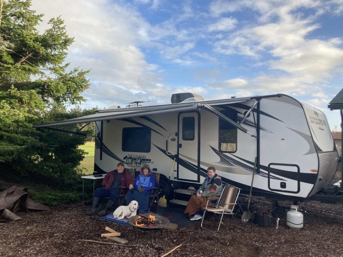
Not only did we obtain a place to moochdock, but he also graciously allowed us to hook up to electricity and access to a hose bib. There was even the bonus of the property fronting a golf course green—which provided a park-like atmosphere for us to enjoy.
Property and cottage for sale
It’s worth noting that he developed this property placing a rustic two-bedroom “cottage” on the site which is currently for sale. Click here if you are interested in living near the ocean on a golf course! If you take a look in person, let them know Dave sent you. If you buy it, as a finder’s fee, you need to let my wife, me, and our friends moochdock once. As a thank you, we will tip you with a bag of clams, as we did the current owner.

After discovering how well the onX app worked in this case, I can envision using it when my wife and I begin traveling cross-country in our RV as well. Since we have friends, distant family members, and acquaintances all across the country, it should serve us well for moochdocking, allowing us to stay out of expensive RV parks.
I suspect other moochdocking types will find it useful too. Learn more about the onX app here!
##RVT1143
So, onX has 3 different apps. Which one are you referring to?
OnX hunt
What a coincidence! My oldest son just started working for onX as a software engineer.
Which is the best OnX version for boondocking?
onX hunt (per Dave). 😀 –Diane at RVtravel.com
Thank you, Dave! This looks like a good application to try. Thank you, too, for so graciously welcoming me today. I enjoyed the time between sessions as well as the sessions. I certainly will be using my computer more going forward now that you have convinced me of the merits of Google Earth. 🙂 Enjoy the Lost Sea and exploring the battlefield in Franklin. Tennessee was initially called Franklin (as in the state of Franklin) before it changed to Tennessee. Safe travels! 🙂